


Voting District UG, Iredell County, North Carolina
About
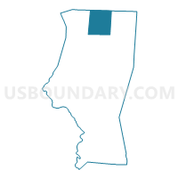
Outline

Summary
| Unique Area Identifier | 640509 |
| Name | Voting District UG |
| County | Iredell County |
| State | North Carolina |
| Area (square miles) | 31.13 |
| Land Area (square miles) | 30.92 |
| Water Area (square miles) | 0.21 |
| % of Land Area | 99.33 |
| % of Water Area | 0.67 |
| Latitude of the Internal Point | 36.00867730 |
| Longtitude of the Internal Point | -80.85436970 |
Maps


Graphs
Select a template below for downloading or customizing gragh for Voting District UG, Iredell County, North Carolina


Neighbors
Neighoring Voting District (by Name) Neighboring Voting District on the Map
- Voting District 122, Wilkes County, NC
- Voting District EM, Iredell County, NC
- Voting District NH, Iredell County, NC
- Voting District OL, Iredell County, NC
- Voting District SB, Iredell County, NC
- Voting District SBCK, Yadkin County, NC
- Voting District TB, Iredell County, NC
Top 10 Neighboring County Subdivision (by Population) Neighboring County Subdivision on the Map
- Turnersburg township, Iredell County, NC (3,880)
- Sharpesburg township, Iredell County, NC (2,622)
- Union Grove township, Iredell County, NC (2,170)
- Eagle Mills township, Iredell County, NC (1,912)
- Olin township, Iredell County, NC (1,840)
- New Hope township, Iredell County, NC (1,662)
- South Buck Shoals township, Yadkin County, NC (1,368)
- Somers township, Wilkes County, NC (1,077)
Top 10 Neighboring Unified School District (by Population) Neighboring Unified School District on the Map
- Iredell-Statesville Schools, NC (131,920)
- Wilkes County Schools, NC (69,340)
- Yadkin County Schools, NC (38,406)
Top 10 Neighboring State Legislative District Lower Chamber (by Population) Neighboring State Legislative District Lower Chamber on the Map
- State House District 79, NC (74,556)
- State House District 94, NC (69,340)
- State House District 92, NC (68,165)
Top 10 Neighboring State Legislative District Upper Chamber (by Population) Neighboring State Legislative District Upper Chamber on the Map
- State Senate District 45, NC (184,898)
- State Senate District 42, NC (184,148)
- State Senate District 30, NC (170,635)
Top 10 Neighboring 111th Congressional District (by Population) Neighboring 111th Congressional District on the Map
Top 10 Neighboring Census Tract (by Population) Neighboring Census Tract on the Map
- Census Tract 9612, Wilkes County, NC (7,171)
- Census Tract 504, Yadkin County, NC (6,729)
- Census Tract 608.01, Iredell County, NC (3,482)
- Census Tract 609.01, Iredell County, NC (3,186)